
New satellite images show damage to Crimean Bridge
Monday, 17 July 2023, 21:14
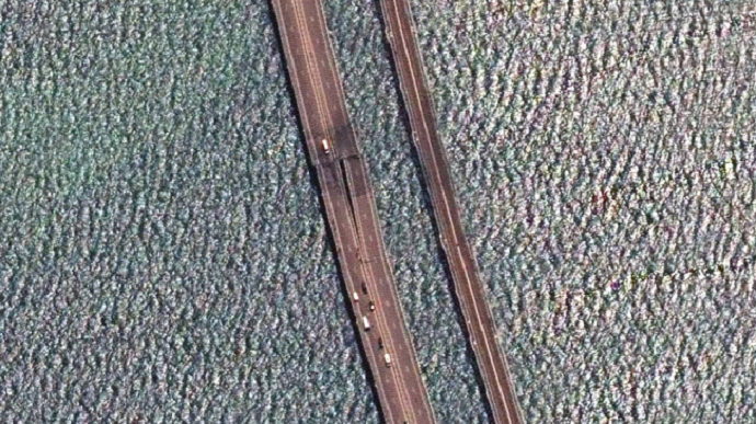
Maxar Technologies has shared new satellite images which capture the damage caused by today’s attack on the Crimean Bridge.
Source: Crimea.Reality (Krym.Realii), a Radio Liberty project covering Crimea
Details: Crimea.Reality reported that the images show that the northern part of the bridge, closer to mainland Russia, was damaged.
Advertisement:
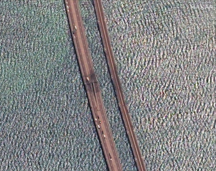
The previous explosion damaged the part nearer to Russian-occupied Crimea.
Background:
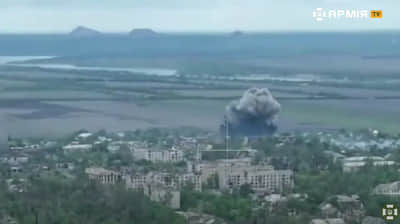
- The Crimean Bridge was attacked at three in the morning on Monday, 17 July. The bridge connects Russian-occupied Crimea and mainland Russia.
- Sources in Ukraine’s Security Service told Ukrainska Pravda that the attack was a special operation by the Security Service of Ukraine and the Ukrainian Navy using surface drones.
- Russian media reported that two drones were deployed in the attack, which caused one of the bridge spans to tilt to one side. The operation of the ferry crossing between the occupied peninsula and Russia’s Krasnodar Krai has been stopped, and car traffic on the bridge has also been temporarily suspended. Traffic has been rerouted via the occupied territories of mainland Ukraine.
- Russian occupation authorities expect to open one side of the bridge to two-way traffic on 15 September; the other side of the bridge will open for traffic in November. One of the bridge’s spans cannot be repaired.
Journalists fight on their own frontline. Support Ukrainska Pravda or become our patron!