Ukraine develops AI-powered drone for surveying mined land – photos

A new Ukrainian technology featuring artificial intelligence enables mine-contaminated areas to be surveyed 100 times faster than a sapper could. The innovation was presented by the company UADamage, which cooperates with the state-backed tech cluster Brave1.
Source: Oboronka, a defence industry project by Mezha.Media, a technology and IT news platform within Ukrainska Pravda's holding company
Details: Developers have integrated AI into a drone capable of surveying 10,000 square metres per day. For comparison, a single person can cover just 100 square metres in the same amount of time. The system can detect explosive devices with an accuracy of five centimetres.
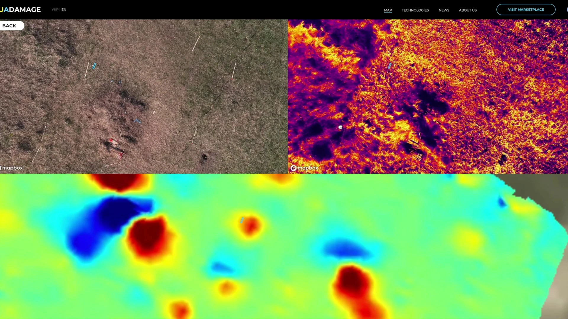
The drone is equipped with four sensors: an RGB camera, an infrared camera, a magnetometer and ground-penetrating radar. Data from all sensors is combined to produce a detailed map of the mined area. Once the drone lands, transferring the data to a computer takes no more than ten minutes.
The development was made possible through grants from Brave1, which allowed the company to purchase specialised sensors and build the AI-based system capable of automatically identifying various types of mines and explosive objects. Recently, UADamage also secured US$400,000 in investment to scale up the project.

So far, the company has flown over 61,000 square metres of mined fields and digitally mapped 520,000 square metres. In the future, the developers plan to adapt their technology for use on ground-based robots.
Support Ukrainska Pravda on Patreon!