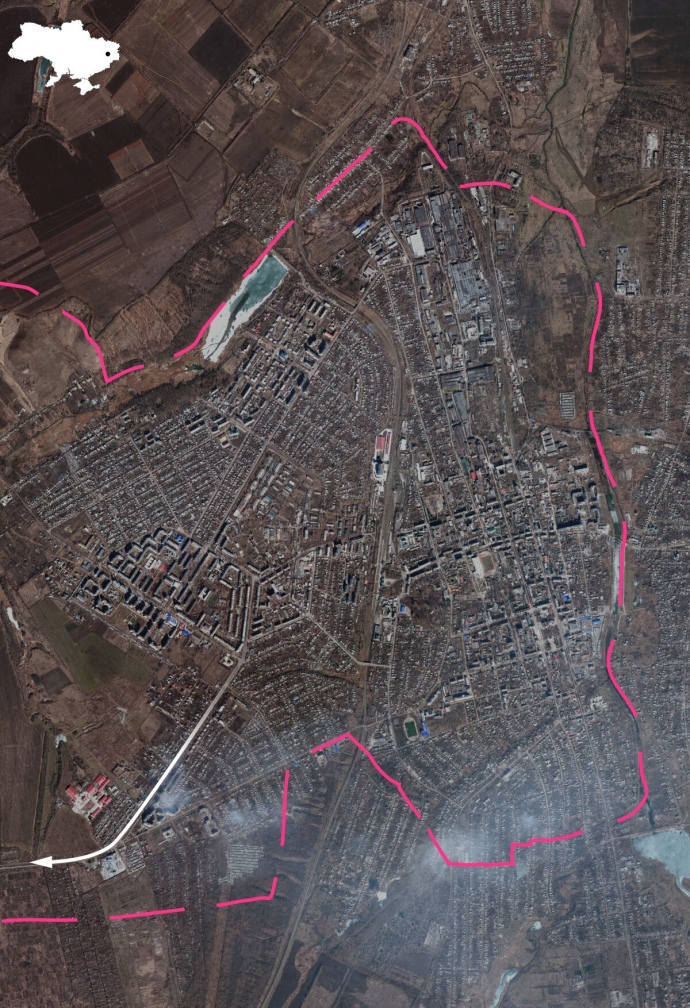
Satellite shows large-scale destruction of Bakhmut

Maxar Technologies has published fresh satellite images of Bakhmut, Donetsk Oblast, which show, in particular, the destruction of bridges across the Bakhmutka River.
Source: The New York Times
Details: Satellite images show that the eastern part of the city, which is currently occupied by Russians, was the most affected.
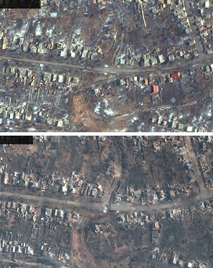
In the photo, taken on 6 March, it can be seen that the bridges over the Bakhmutka River, which divides the city in half, have been destroyed and, as the NYT writes, can be used by the Ukrainian Armed Forces to deter the enemy.
In addition, another image from 6 March shows that an area and a bridge in Bakhmut's south have been heavily damaged over the past few weeks.
In the pictures from 23 February, viewers can also see large-scale damage to industrial plants, residential buildings and bridges.
Update: Ukrainska Pravda sources in the military have confirmed that Ukrainian defenders have withdrawn from the Zabakhmutka area, located east of the Bakhmutka River.
Background:
- On 4 March, British Intelligence reported that within the last 36 hours, two key bridges in Bakhmut had been destroyed, including a vital bridge connecting the city with the last main supply route from Bakhmut to the city of Chasiv Yar.
Journalists fight on their own frontline. Support Ukrainska Pravda or become our patron!